
On this page0% through guide
Earth Systems and Resources
Earth’s physical systems set the conditions for ecosystems and human use.
What you’ll learn
- Connect plate tectonics to landforms and hazards.
- Interpret soil and watershed processes.
- Explain atmospheric circulation and climate patterns.
Before you begin
Weather describes short-term atmospheric conditions; climate describes longer-term patterns. Permeability concerns water movement through connected spaces, while porosity concerns the fraction of empty space.
Explain these starting ideas in your own words. Revisit them whenever a later step feels unclear.
Plate boundaries concentrate geological activity
Divergent boundaries separate plates and can create new crust; convergent boundaries bring plates together and may involve subduction or mountain building; transform boundaries involve lateral motion. Earthquakes and volcanoes have different distributions depending on the boundary process.
A hazard becomes a human risk through exposure and vulnerability. Dense development on unstable slopes or floodplains can increase damage even without a change in the underlying geological process. Monitoring, building design, and land-use planning address different parts of that risk.
Soil forms slowly and performs several functions
Weathering produces mineral particles, while organisms contribute and transform organic matter. Soil horizons reflect movement and accumulation of materials. Texture depends on sand, silt, and clay proportions; structure describes how particles aggregate. Organic matter can improve water retention and nutrient availability.
Permeability, porosity, and water-holding capacity are related but distinct. Large connected pores can allow rapid flow, while small pores can retain water strongly. Compaction can reduce infiltration and root growth. A soil that holds much water does not necessarily make all of it readily available to plants.
Watersheds connect upstream and downstream decisions
A watershed is the land area draining to a common outlet. Surface runoff can carry sediment, nutrients, and pollutants from far upstream. Groundwater moves through permeable materials and can connect to streams, but flow paths and travel times differ from surface flow.
Aquifers store and transmit groundwater. Withdrawal faster than recharge can lower the water table, reduce streamflow, cause subsidence in some settings, or permit saltwater intrusion near coasts. Recharge is limited by precipitation, infiltration, geology, and land cover; groundwater is not an unlimited underground lake.
PAUSE & TRY IT
Why can upstream deforestation affect downstream water quality?
Reveal answer
Reduced cover can increase erosion and runoff, carrying sediment and associated pollutants downstream.
PAUSE & TRY IT
How can coastal pumping cause saltwater intrusion?
Reveal answer
Lower freshwater pressure can allow saline water to move into a freshwater aquifer.
Unequal heating drives circulation
Solar energy varies with latitude, season, and surface characteristics. Warm air tends to rise, cool, and potentially condense moisture; descending air tends to warm and become relatively dry. Earth’s rotation deflects large-scale motion through the Coriolis effect, helping organize wind patterns.
Seasons arise mainly from Earth’s axial tilt, which changes solar angle and day length, not from the small annual change in Earth–Sun distance. Mountains can produce rain shadows as rising air loses moisture on the windward side and descends warmer and drier on the leeward side.
Oceans redistribute heat and nutrients
Surface currents move heat and influence coastal climate. Upwelling can bring cold, nutrient-rich deep water toward the surface, supporting high productivity where light and other conditions permit. Changes in wind patterns can disrupt upwelling and affect fisheries.
El Niño and La Niña involve coupled changes in tropical Pacific ocean and atmospheric conditions. Their effects vary regionally and probabilistically; they do not guarantee one weather outcome in every location. Distinguish a recurring climate pattern from a single storm.
PAUSE & TRY IT
Why can upwelling support productive fisheries?
Reveal answer
It supplies nutrients to lighted surface waters, supporting producers and food webs.
Trace water from precipitation to a well
After precipitation, water may evaporate, run off, infiltrate soil, or percolate toward groundwater. An aquifer stores and transmits groundwater; a confining layer restricts movement. Pumping faster than recharge can lower the water table, reduce stream baseflow, and contribute to subsidence or saltwater intrusion near coasts.
A surface spill can become a groundwater contamination problem if contaminants infiltrate and move with groundwater. Travel times depend on geology and chemistry. Groundwater can remain contaminated long after the original spill stops, so prevention and monitoring are often easier than complete cleanup.
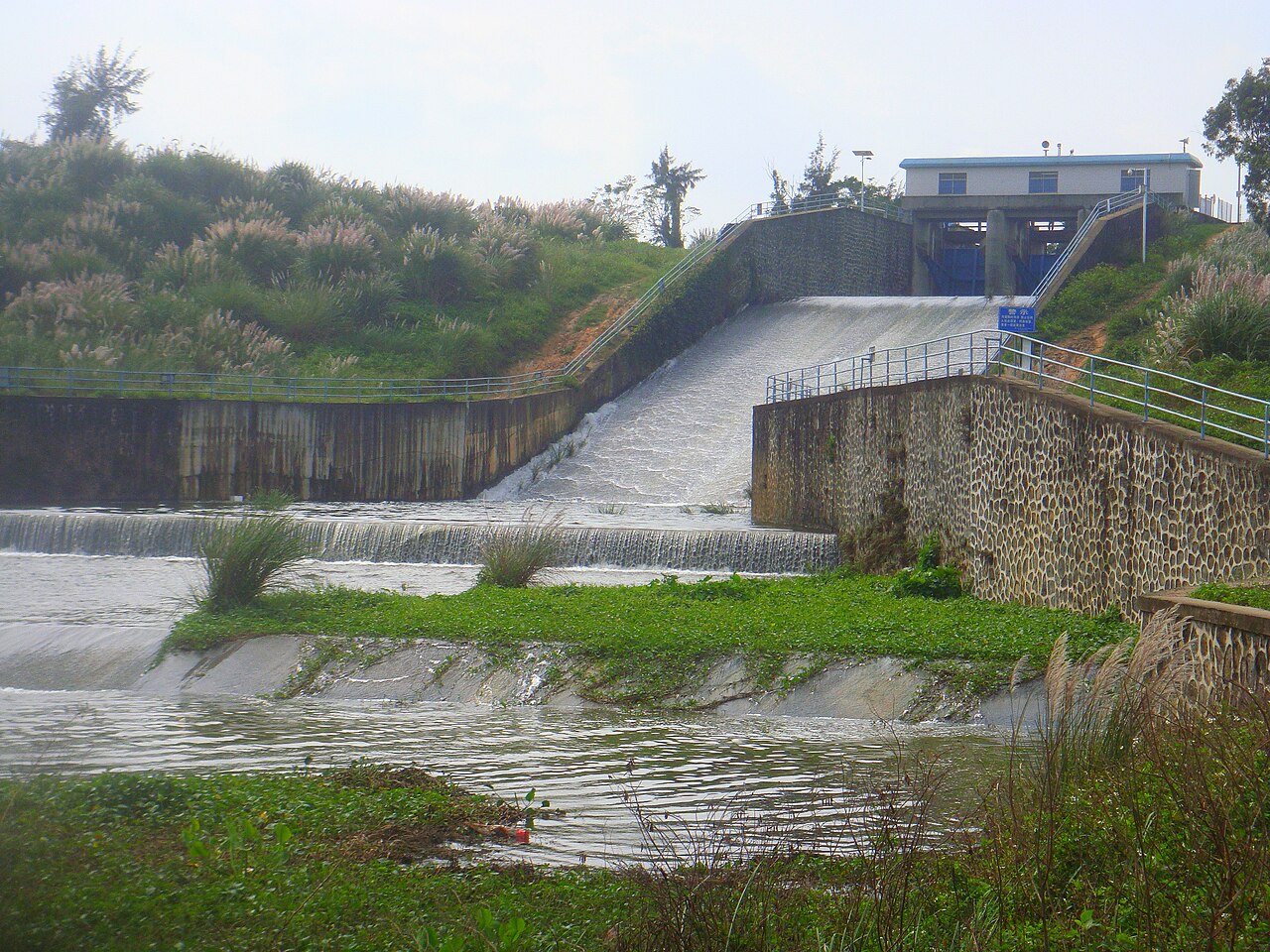
A reservoir’s stored volume depends on its initial volume and net flow over time. The photograph provides context; the small-system numbers used in worked examples are not measurements of this reservoir.
Photo: Anna Frodesiak · Source · CC0 1.0 · Unmodified.Rain can become runoff or infiltrate. Water moving through a watershed can carry dissolved substances and sediment; underground flow depends on permeability.
PAUSE & TRY IT
Why is high porosity not sufficient to guarantee rapid groundwater flow?
Reveal answer
Pore spaces must be sufficiently connected and transmissive; permeability also matters.
Connect soil properties to land management
Sand, silt, and clay differ in particle size, influencing drainage, water retention, and aeration. Organic matter affects nutrient retention, structure, and biological activity. Fine particles may retain water well but transmit it slowly; coarse soils often drain rapidly. Soil quality cannot be reduced to one universally best texture.
Vegetation cover intercepts rainfall and roots help stabilize soil. Removing cover increases exposure to raindrop impact and runoff. Contour planting, cover crops, and reduced tillage can reduce erosion, but their effectiveness depends on slope, rainfall, crop system, and implementation.
PAUSE & TRY IT
How does vegetation reduce erosion?
Reveal answer
It intercepts rain, slows runoff, and stabilizes soil through roots.
Explain circulation with unequal heating
Unequal solar heating creates temperature and density differences that help drive atmospheric circulation. Warm air rises, cools, and may lose moisture through precipitation; sinking air warms and tends to be drier. Earth’s rotation deflects moving air, contributing to prevailing wind patterns rather than causing the initial temperature difference.
Mountains can produce rain shadows: rising air cools on the windward side, while descending air warms on the leeward side. Ocean circulation and events such as El Niño can shift regional rainfall and temperature patterns. Describe the region and mechanism rather than claiming the same effect occurs everywhere.
Build climate explanations from unequal heating
Solar energy is distributed unevenly because of Earth’s geometry, tilt, and surface properties. Unequal heating produces pressure differences and circulation. Air rising in the tropics cools and loses moisture; descending air in subtropical regions tends to warm and dry. Earth’s rotation deflects moving air and water rather than creating the original pressure gradient.
Seasons arise mainly from axial tilt changing solar angle and day length, not Earth moving much closer to the Sun. Elevation, ocean currents, and land–water differences modify regional climates. On a windward mountain slope, rising air can cool and precipitate; descending leeward air can create a rain shadow.
Weather is the short-term atmospheric state; climate summarizes patterns over longer periods. One unusually cold day does not determine a climate trend. Compare consistent locations, time windows, and measurements when interpreting a graph.
Connect geology, soils, and water movement
Plate boundaries produce characteristic processes: divergence creates new crust, convergence can involve subduction or collision, and transform motion produces lateral movement. These processes influence hazards and long-term material cycles. Do not use a single volcano as proof that all boundaries behave the same way.
Soil forms from parent material, weathering, organisms, climate, topography, and time. Sand, silt, and clay describe particle-size classes; organic matter and aggregation also affect soil behavior. Large connected pores can transmit water rapidly, while small pores can retain water strongly. Porosity and permeability are related but not identical.
A soil profile records layers with different processes and compositions. Removing topsoil can reduce nutrients, organic matter, and water-holding ability. Replacing fertilizer does not automatically restore soil structure or the biological functions lost through erosion.
PAUSE & TRY IT
Can a material have high porosity but low permeability?
Reveal answer
Yes. Many pore spaces can store water while poor connectivity or very small pathways limit the rate at which it flows.
Read a watershed as a transport system
A watershed drains toward a common outlet. Water can run overland, infiltrate soil, recharge groundwater, or return to the atmosphere. Impervious surfaces often increase rapid runoff and reduce infiltration, raising peak flow after storms. A flood-risk explanation should connect land cover to the timing and volume of flow.
Groundwater occupies pore spaces and fractures below the water table. Pumping faster than recharge can lower the water table, increase pumping costs, cause subsidence in some settings, or allow saltwater intrusion near coasts. An aquifer is not necessarily an underground open lake.
For a management proposal, compare upstream and downstream consequences. Detention, permeable surfaces, vegetation, and floodplain protection act through different mechanisms. Their effectiveness depends on soil, storm intensity, maintenance, and available area.
Read figure values as text
More impervious cover: 0: 1; 1: 8; 2: 4; 3: 2; 4: 1; 5: 1; 6: 1 • More permeable cover: 0: 1; 1: 2; 2: 3; 3: 4; 4: 3; 5: 2; 6: 1
Use a soil triangle and infiltration evidence carefully
Sand, silt, and clay percentages sum to 100 for the mineral particle-size composition used in a soil-texture triangle. Follow the triangle’s labeled axes rather than reading it like a rectangular graph. Organic matter is important to soil function but is not a fourth percentage axis on that texture triangle.
Texture influences water retention and drainage, while structure, compaction, organic matter, and pore connectivity also matter. A compacted soil can infiltrate slowly even if its particle-size category suggests a more permeable material. Describe the observed property rather than assuming texture alone determines it.
In a field comparison, standardize initial moisture, sample area, and application rate when measuring infiltration. Different antecedent conditions can produce different runoff from the same soil. A repeated measurement after rainfall may not be directly comparable with one after a long dry period.
PAUSE & TRY IT
Why can identical rainfall produce different runoff on different days?
Reveal answer
Initial soil moisture, vegetation, surface condition, and rainfall intensity can change infiltration and storage.
Separate a hazard from the exposure it creates
Earthquakes, volcanic activity, storms, and floods are physical events; risk also depends on where people and infrastructure are located and how vulnerable they are. The same magnitude event can have different consequences under different construction, warning, and land-use conditions.
A plate-boundary explanation should connect motion to stress or magma processes. Transform boundaries involve lateral motion and commonly earthquakes; subduction can generate earthquakes and volcanism. A hazard map describes probability or exposure under assumptions, not a precise prediction of the next event.
Watershed management can reduce exposure by preserving floodplains or slowing runoff, but no intervention guarantees protection from every event. State the event range, maintenance needs, and potential downstream effects when evaluating an engineering proposal.
FROM IDEA TO APPLICATION
Worked examples
A recharge budget
An aquifer receives 8 million m3 of recharge annually and withdrawals are 11 million m3, with other flows ignored. Estimate annual storage change.
Reveal worked solution
- Storage change = input − output.
- 8 − 11 = −3 million m3 per year.
Storage decreases by about 3 million m3 annually under the simplified budget.
Explain a rain shadow
Why can two sides of a mountain range at similar latitude have very different rainfall?
Reveal worked solution
- Moist air rises on the windward side and cools.
- Condensation and precipitation remove water.
- Descending leeward air warms, reducing relative humidity.
Mountain-driven lifting and descent can produce a wetter windward side and drier leeward side.
A groundwater budget
An aquifer receives 12 million of recharge and loses 3 million through natural discharge. Pumping removes 11 million. Estimate annual storage change.
Reveal worked solution
- Add inputs: 12 million .
- Add outputs: 3+11=14 million .
- Subtract outputs from inputs.
Storage decreases by 2 million under the stated budget.
Estimate runoff volume
A 20 mm storm falls on 10,000 m2. If 70% becomes runoff, estimate runoff volume.
Reveal worked solution
- Convert 20 mm to 0.020 m.
- Rain volume = 0.020 × 10,000 = 200 m3.
- Runoff = 0.70 × 200 = 140 m3.
140 m3, assuming the stated runoff fraction applies to the whole site.
Check a soil composition
A mineral soil is reported as 40% sand, 35% silt, and 25% clay.
Reveal worked solution
- The percentages total 100%.
- Use the labeled soil triangle to locate the texture class.
- Do not infer organic content or compaction from those percentages alone.
The composition is internally consistent, but hydraulic behavior needs more information.
Convert rainfall depth
A 5 cm rain falls uniformly over 2 hectares. Find volume before losses.
Reveal worked solution
- 5 cm=0.05 m and 2 ha=20,000 m2.
- Volume=0.05×20,000.
1,000 m3 of precipitation.
MAKE THE DISTINCTION
Common mistakes, clearer reasoning
The trapSummer occurs because Earth is much closer to the Sun.
The better explanationAxial tilt and resulting solar angle and day length dominate seasonal differences.
The trapPorosity and permeability mean the same thing.
The better explanationPorosity is pore-space fraction; permeability concerns how readily connected pathways transmit fluid.
RETRIEVE BEFORE YOU REVEAL
Practice checkpoints
Revisit the quick checks from this guide without looking back. Explain why, then reveal the answer.
1. Why can upstream deforestation affect downstream water quality?
Reveal answer
Reduced cover can increase erosion and runoff, carrying sediment and associated pollutants downstream.
2. How can coastal pumping cause saltwater intrusion?
Reveal answer
Lower freshwater pressure can allow saline water to move into a freshwater aquifer.
3. Why can upwelling support productive fisheries?
Reveal answer
It supplies nutrients to lighted surface waters, supporting producers and food webs.
4. Why is high porosity not sufficient to guarantee rapid groundwater flow?
Reveal answer
Pore spaces must be sufficiently connected and transmissive; permeability also matters.
5. How does vegetation reduce erosion?
Reveal answer
It intercepts rain, slows runoff, and stabilizes soil through roots.
6. Can a material have high porosity but low permeability?
Reveal answer
Yes. Many pore spaces can store water while poor connectivity or very small pathways limit the rate at which it flows.
7. Why can identical rainfall produce different runoff on different days?
Reveal answer
Initial soil moisture, vegetation, surface condition, and rainfall intensity can change infiltration and storage.
Key language
- Watershed
- Land draining to a common outlet.
- Aquifer
- A geological formation that stores and transmits groundwater.
- Infiltration
- Movement of water from the surface into soil.
- Rain shadow
- A relatively dry region leeward of a moisture-removing mountain barrier.
Physical systems constrain agriculture, freshwater supply, pollution transport, and climate responses.